


Geoportal
GeORG mapviewer
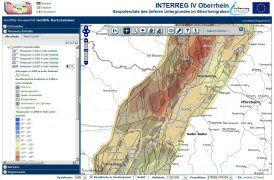
The GeORG mapviewer is an interactive web mapping application, where project results can be searched, spatially visualized and queried. It also allows for dynamic generation of vertical and horizontal geological sections and prognostic drilling profiles.http://maps.geopotenziale.eu
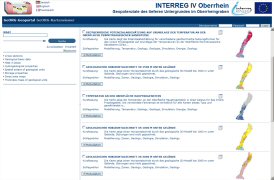
GeORG metadata
GeORG metadata provides information on the availability of spatial data as web mapping services (WMS), about the access to these WMS and restrictions of use. The metadata profile complies with the requirements of the EU directive INSPIRE and national spatial data infrastructures.
http://geo.geopotenziale.eu
 This project is co-financed by the European Union